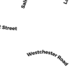
26-28 WESTCHESTER RD
Owner Information
26-28 WESTCHESTER RD MASTER DEED
None
None, None None


Property Details
26-28 WESTCHESTER RD is classified as a Other, Open Space (Condominium).
The primary structure on this property was built in 1926. There are 4,322ft2 of built area within this property. There is 2,808ft2 of residential/living space within this property.
26-28 WESTCHESTER RD is valued at $0. The land is valued at $0 and the structures are valued at $0.
This property is in Zone MR1. Confirm with local Zoning Board authorities to ensure there are no overlays or other easements on this property.
The most recent deed for 26-28 WESTCHESTER RD is recorded at the local registrar in Book 41167, Page 398.
Assessment data from fiscal year 2022.
Flood Data
According to the FEMA National Flood Hazard Layer, this property does not appear to be in a flood zone. It may also be in an area not yet reviewed. Nonetheless, confirm this information prior to taking any action.
To view the flood hazards around this property, create a FEMA "Firmette" Map of the area around 26-28 WESTCHESTER RD.
Broadband Internet Providers
| Provider | Type | Bandwidth (mbps) | |
|---|---|---|---|
| VSAT Systems, LLC. | Satellite | 2 | 1 |
| HughesNet | Satellite | 25 | 3 |
| Comcast | Cable | 1000 | 35 |
| Verizon New England Inc. | Fiber | 940 | 880 |
| GCI Communication Corp. | Satellite | 0 | 0 |
| RCN | Cable | 500 | 20 |
| Verizon New England Inc. | DSL | 7 | 0 |
| Viasat Inc | Satellite | 100 | 3 |
Broadband service provider data from December 2020.
Adjacent Properties
- 14-16 WESTCHESTER RD
Two-Family Residential owned by KARAYAN IRENE TR - 36-38 WESTCHESTER RD
Two-Family Residential owned by LAW HENRY KIN KEI & PANDORA FUNG - 176-178 CABOT ST 176
Residential Condominium owned by PICCIRELLI CHERYL - 176-178 CABOT ST 178
Residential Condominium owned by ADINARAYANAN RAGU - 176-178 CABOT ST
Other, Open Space owned by 176-178 CABOT ST MASTER DEED - 182-184 CABOT ST
Two-Family Residential owned by LAU DAVID